Good morning all,
During indoor test, when we try to activate the altitude mode, QGROUNDCONTROL STATION, reports the error not valid altitude estimate
My configuration is:
-Pixhawk 6X
Lidar TF MINI PLUS
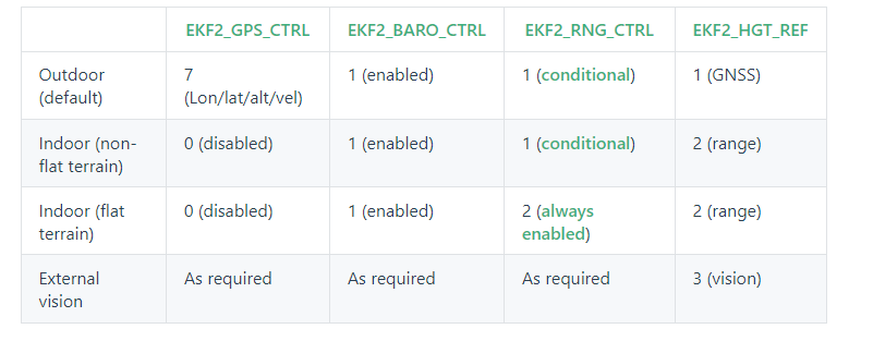
For EKF2 setup i followed the indication reported in the table below (Indoor Flat Terrain)
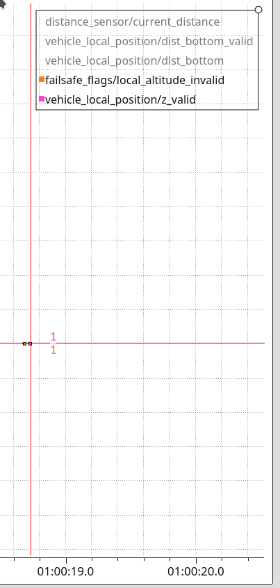
The LIDAR is working, in fact when I read the altitude from MAVLINK Ispector the altitude reported is correct )
i’ll attach a log file https://review.px4.io/plot_app?log=700a0b35-2834-4e1a-9397-f4f1947d0d4a
Kind regards,
Giuseppe
Hi Igor,
Firstly I want to thank you for the fast reply.
Unfortunaly I’m pretty new to PX4 firmware, what action I had to take in order to solve the problems?
Looking forward to hear from you I wish you an happy days